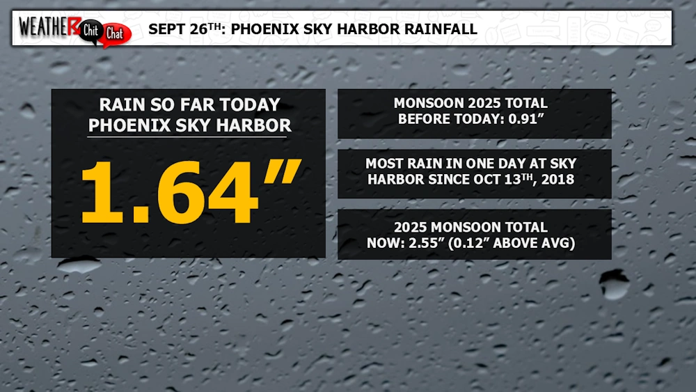
What a day across the Valley of the Sun as several rounds of strong to severe thunderstorms moved through the region, as an area of low pressure moved eastward, centering itself over the [...] Read more
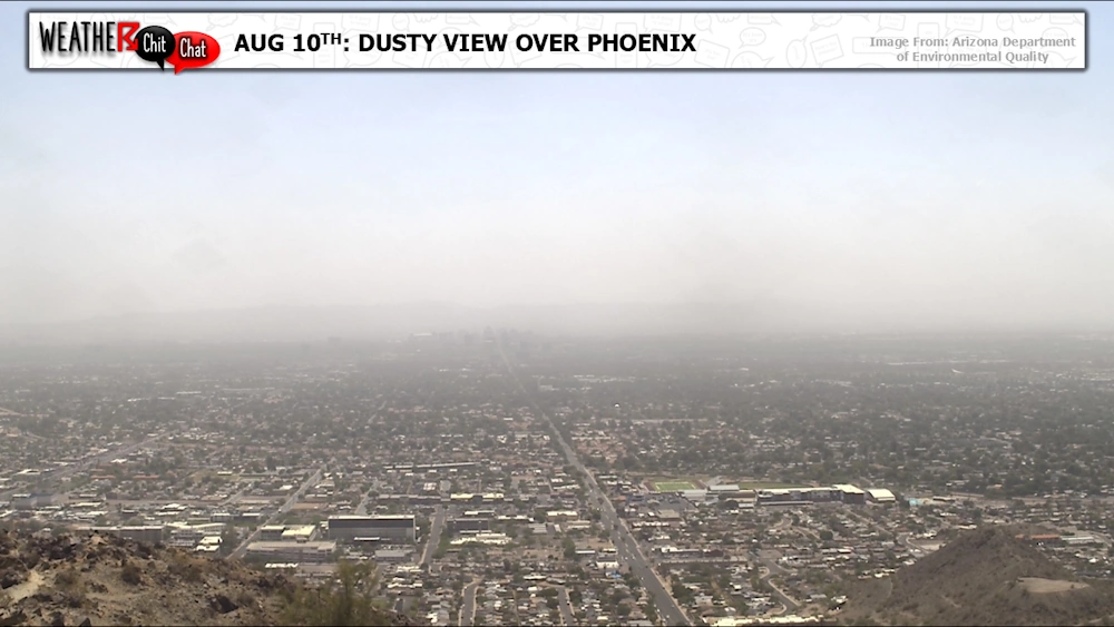
Did you notice the haze outside on this Sunday (August 10th)? It is all thanks to a very large complex of thunderstorms that developed just south of Arizona yesterday afternoon/evening. As this [...] Read more
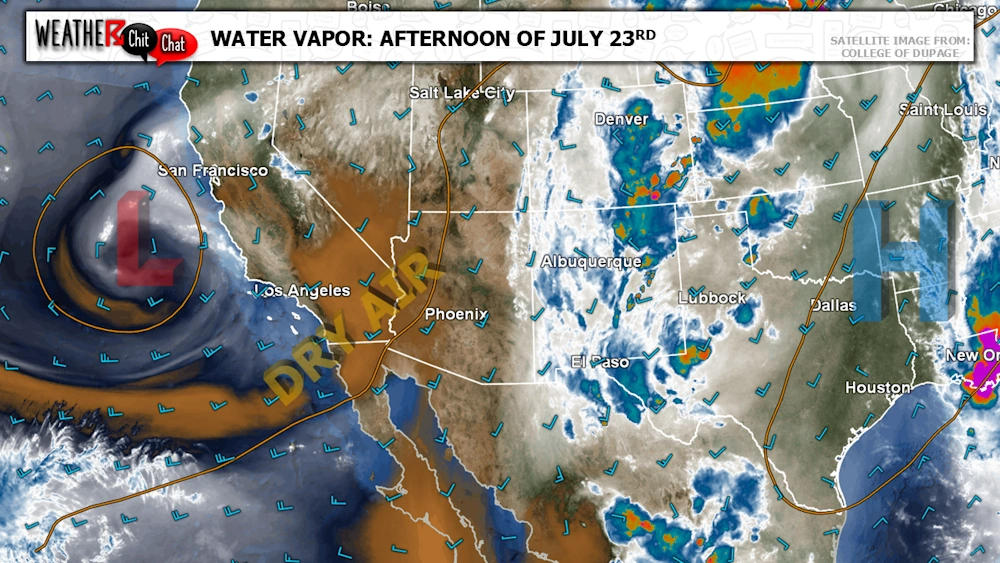
Hello, dry air! The monsoon ridge has shifted well east into the Plains as an area of low pressure sits just off the West Coast. This brings a dry southwest flow into the region, which will [...] Read more
Monsoon is the time of year many of us look forward to as active weather moves into the forecast! So what exactly is the “monsoon?" Below is a post we put together many years ago, to help people [...] Read more
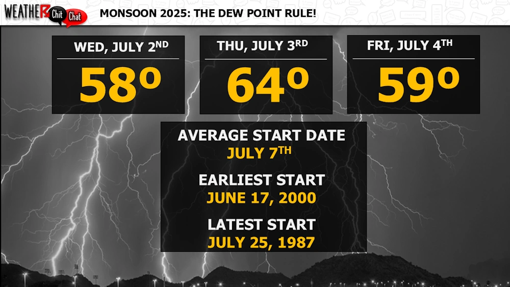
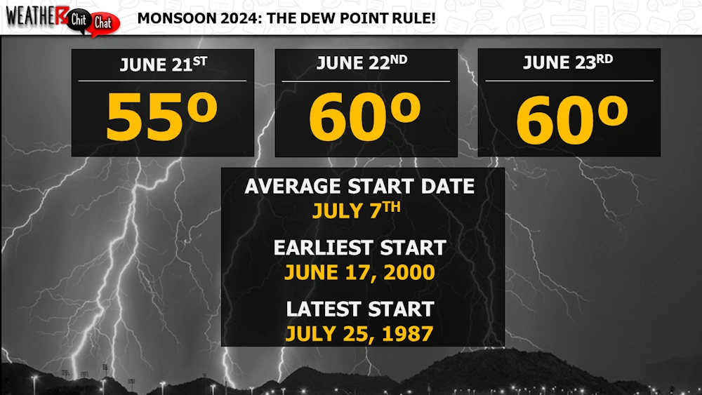
Officially, Monsoon 2025 started on June 15th; however, before 2008, the monsoon did not begin in Phoenix until the daily average dew point was 55°F or higher for three consecutive days. This was [...] Read more
Monsoon 2025 is starting to get more active! High pressure near the Four Corners has allowed moisture to move into the region, especially across Eastern Arizona and New Mexico. As a result, we have [...] Read more
Even though a big uptick in moisture and widespread thunderstorm activity is likely still a couple of weeks away, Monsoon 2025 started today (June 15th). In 2008. The National Weather Service [...] Read more
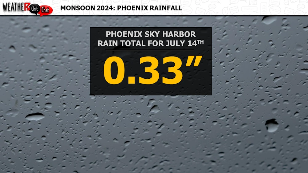
Phoenix Sky Harbor received 0.33" of rain in about 15 minutes on July 14th as outflows converged, spawning isolated strong to severe storms across portions of the Valley. While this might not seem [...] Read more
If you lived in Arizona before 2008, you likely remember everyone talking about the dew point to start the monsoon. Before 2008, the start date was determined based on Phoenix Sky Harbor having a [...] Read more
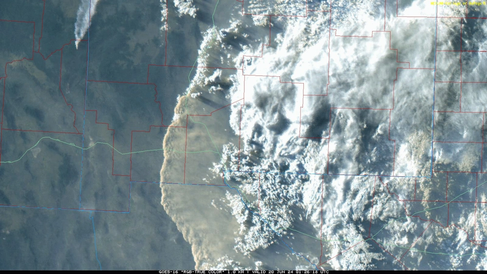
Notice the haze around the area? Strong to severe thunderstorms in New Mexico, fueled partly by moisture from former Tropical Storm Alberto, developed across the eastern portion of New Mexico during [...] Read more