Monsoon takes a break in Arizona
Posted on July 23, 2025
by
WeatherChitChat
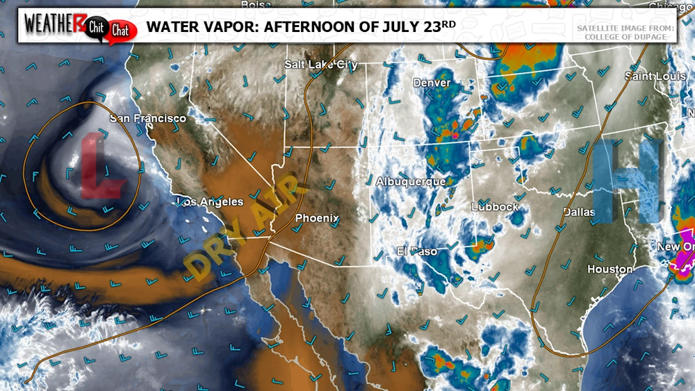
Hello, dry air! The monsoon ridge has shifted well east into the Plains as an area of low pressure sits just off the West Coast. This brings a dry southwest flow into the region, which will significantly limit thunderstorm activity across the state through the weekend.
You can see this dry air (brown on the map above) moving into the state from the southwest, as the low has a counterclockwise flow. Note the moisture (represented by white and blue colors) over New Mexico, wrapping around the area of high pressure centered over Arkansas.
It is fairly common to experience breaks during the monsoon, and it appears that by the middle to end of next week, things may begin to become more active across the region. Stay tuned!